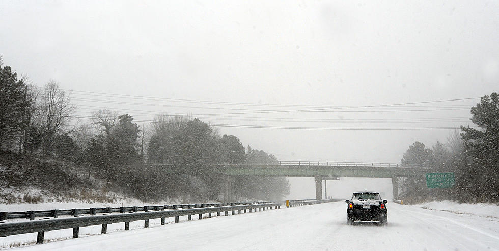
WINTER STORM WARNING: 2 FEET OF SNOW & 50 MPH WINDS
Don't let the warm 50+ degrees we enjoyed today fool you. Winter is not letting go quite yet. In fact, there's another BIG winter storm headed for the Cascade Mountain passes that could produce upwards of 2 feet of snow.
While the chance for any significant amount of snow here in the Valley is unlikely, we will endure a HIGH WIND ADVISORY which will produce gusts of wind near 40 MPH Thursday and Friday.
The National Weather Service has issued the following warning for some heavy snow: on Snoqualmie Pass:
* WHAT...Heavy snow expected above 3000 feet. Total snow accumulations of 12 to 24 inches possible along the Cascade crest and 3 to 6 inches in the lower elevations. Winds gusting as high as 50 mph Thursday night and Friday.
* WHERE...East Slopes of the Washington Cascades.
* WHEN...From 1 AM Thursday to 10 PM PST Friday.
* IMPACTS...Travel could be very difficult to impossible. The hazardous conditions could impact the morning or evening commute. Strong winds could cause tree damage.
* ADDITIONAL DETAILS...Blowing snow could be an issue due to the strong winds.
After an extended stretch within the past couple of weeks where there was so much snow, 36 inches had fallen on Snoqualmie Pass over a 48 hour period, followed by lengthy pass closures and avalanche concerns, another two feet dumping followed by warmer temperatures, may result in even more trouble. The best recommendation is to avoid the mountain passes until this winter storm has passed.
And as the warning indicates, it won't just be the snowfall, but the winds gusting to over 50 miles per hour that will keep most drivers home.
KEEP READING: Get answers to 51 of the most frequently asked weather questions...
See the Must-Drive Roads in Every State
More From 92.9 The Bull

![Yakima Valley Weather Causes Lots Of Closures – Your Complete List [UPDATED]](http://townsquare.media/site/139/files/2017/02/GettyImages-107674837.jpg?w=980&q=75)


